Terra Incognita
Codex
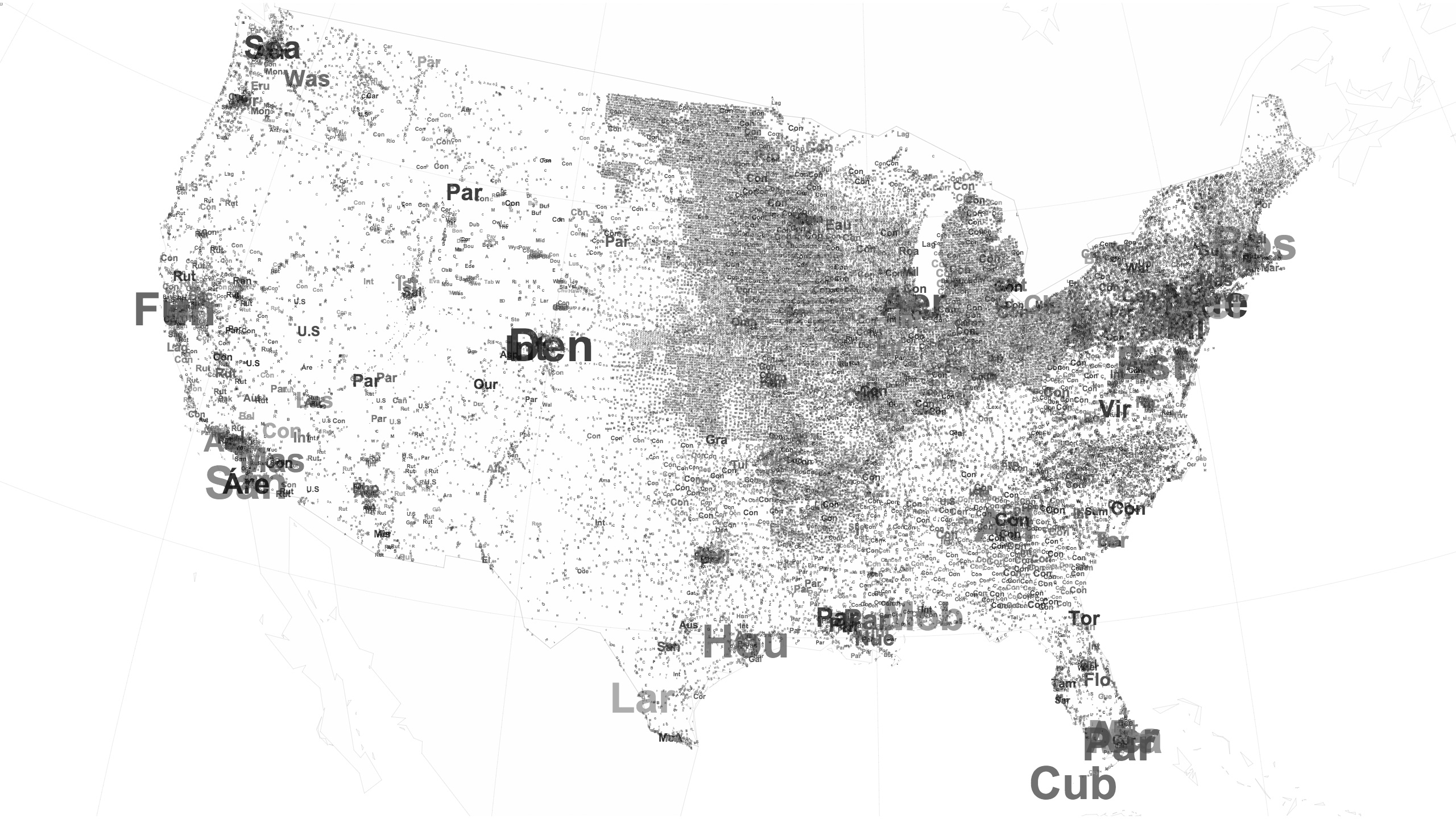
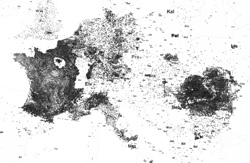
This version of the project explores how the textual metadata of Wikipedia delineates space. In these experiments fragments of the article titles are used to map the encyclopaedias geographies. The resulting glyphs and phonemes hint at the underlying content and its structures - fields of partial signs and utterances. En masse the texts form concretions of Wikipedia contributions, remnants of collective activity and shared bodies of knowledge.
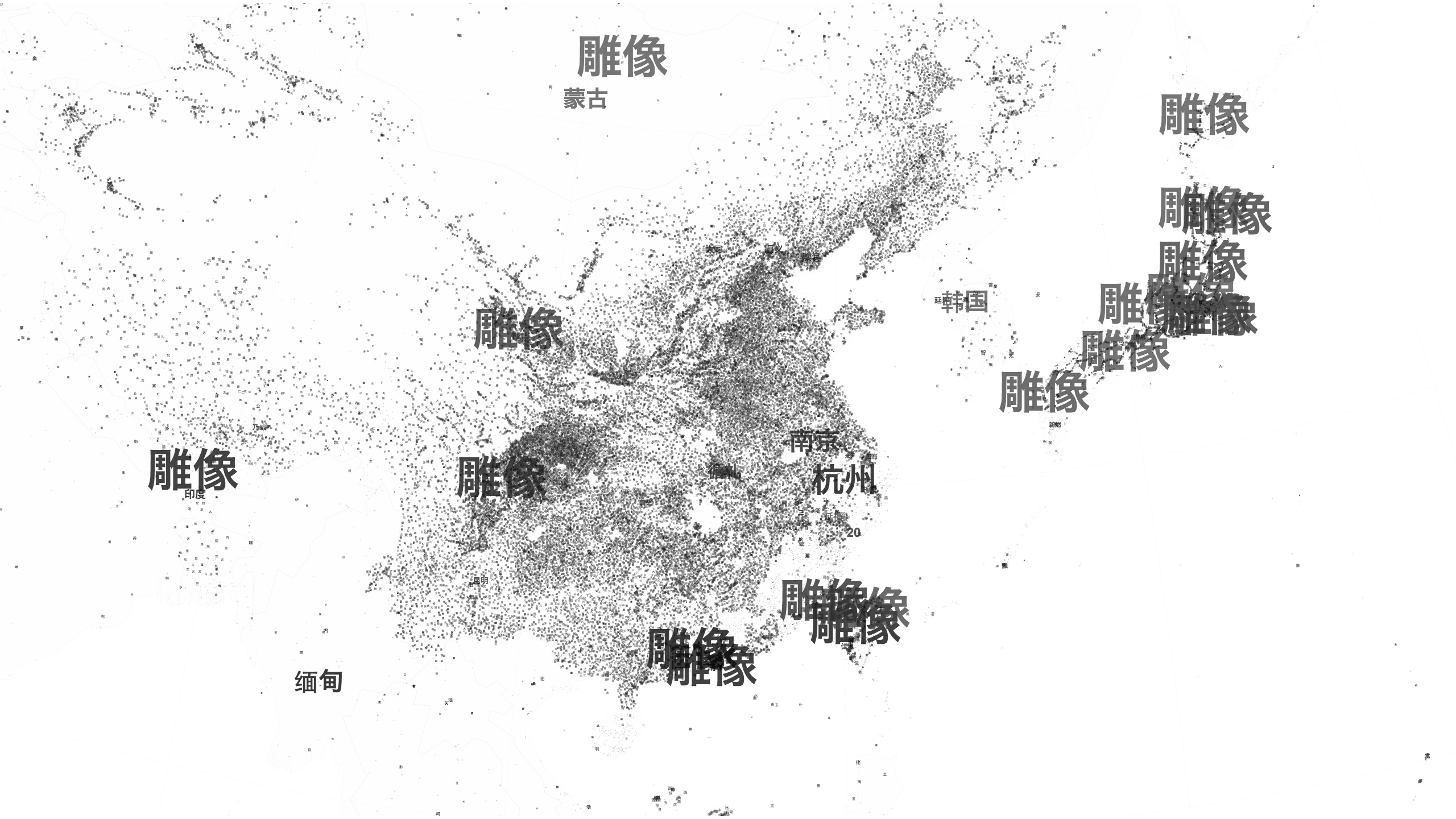
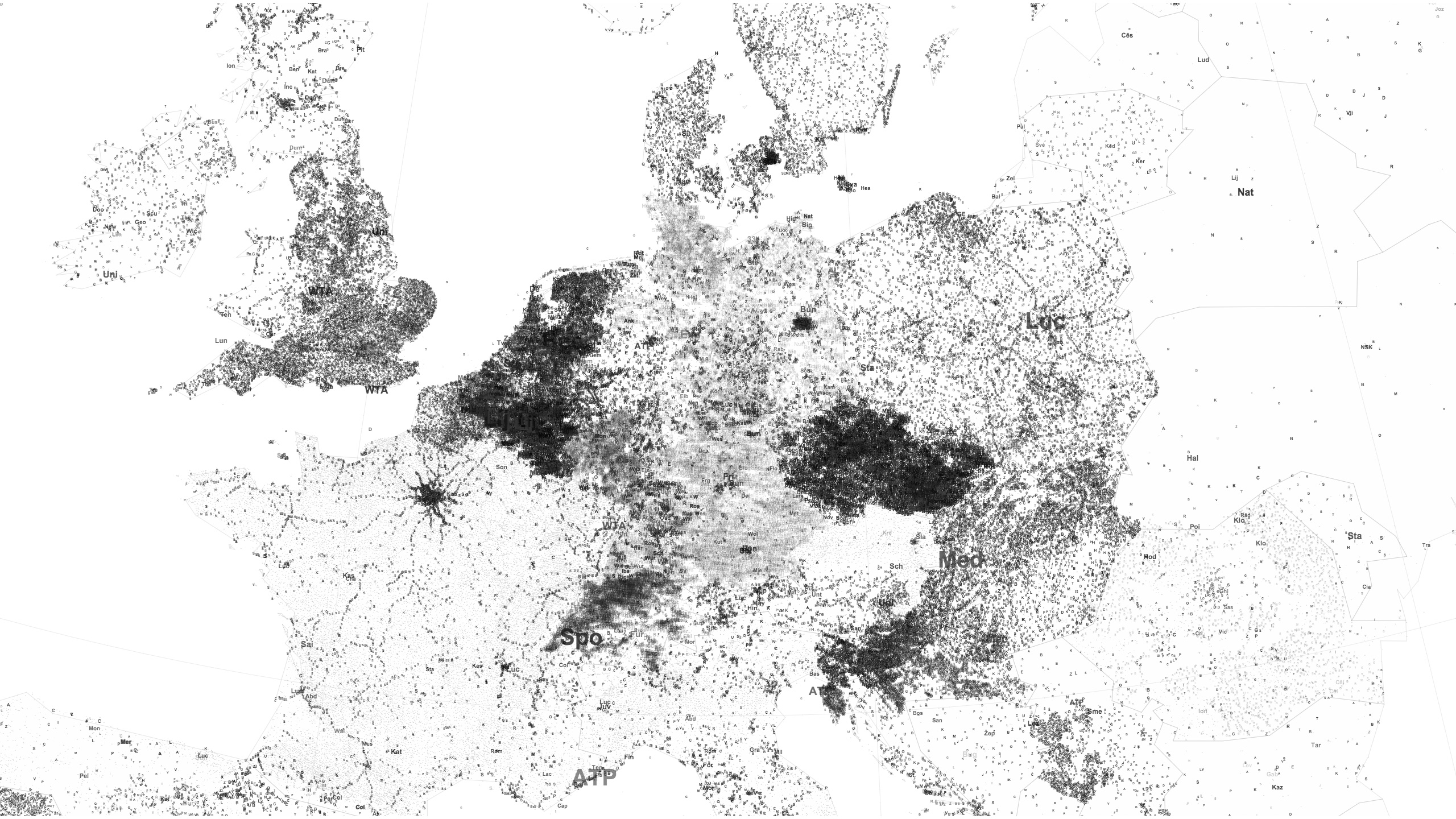
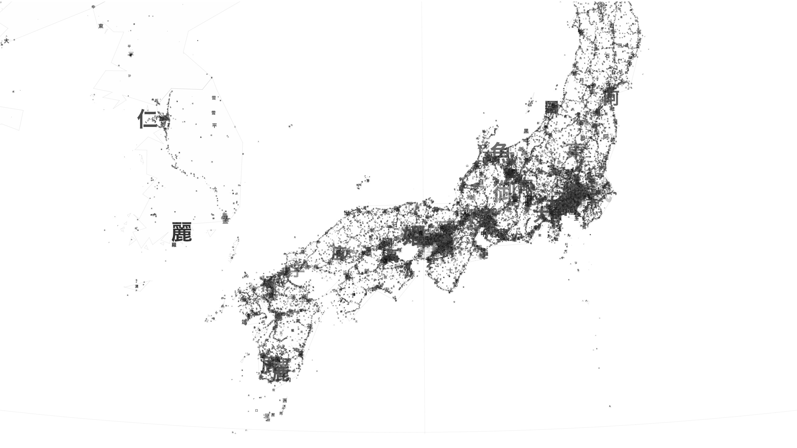
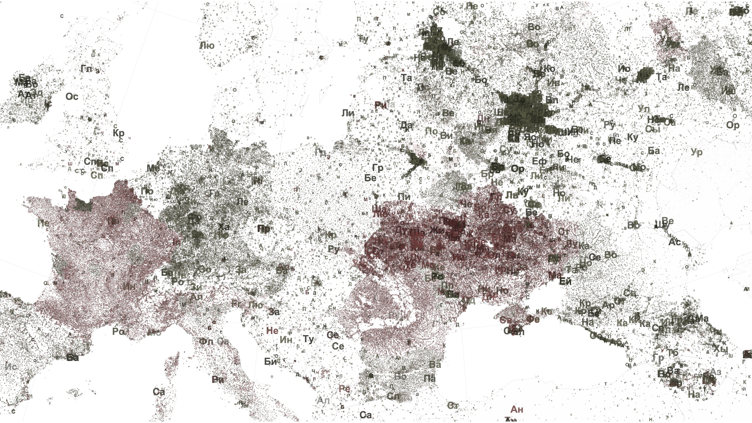
The structures of the encyclopaedia are visualised by mapping the text properties to the characteristics of the articles. For example, the text fragments can be scaled in relation to the number of images associated with each article. The effect of this is a differential texturing across the map, where major articles appear as large-scale labels and less developed but more abundant articles form topographies of varying density.
Animations
The following videos show the evolution of a number of language editions between 2001 to 2013, looking in particular at how the official language of a country is represented. The articles are shown according to their creation date using a timeframe of roughly a year. This reveals the periods at which authors are focused on particular geographic regions and content domains.
Chinese - images metric 2001 to 2013
French - images metric 2001 to 2013
Japanese - images metric 2001 to 2013
Russian - images metric 2001 to 2013
Persian Arabic Portuguese English in the Gulf - images metric 2001 to 2013
Images
The densities of the maps below reflect the number of images representing each location.
-
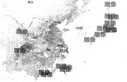
Chinese
-

Dutch
-

French
-
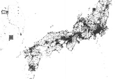
Japanese
-
Romanian
-

Russian
-

Russian & Ukrainian
-

Spanish in the US